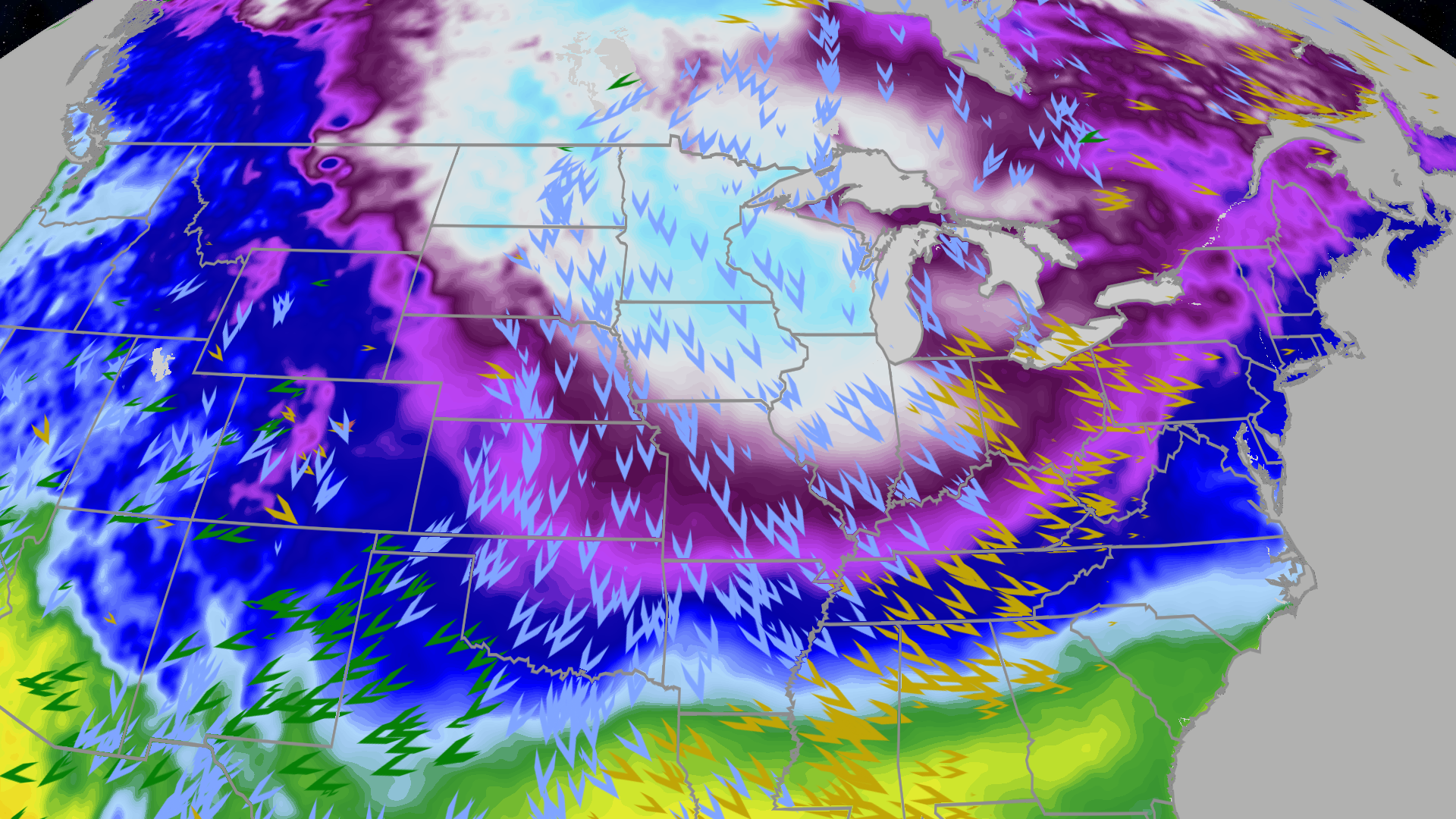
An arctic blast is moving through the Central Plains, Midwest, Great Lakes and much of the East, driving temperatures well below normal—more than 30 degrees below average in spots—with daytime highs in the single digits across parts of Minnesota to Indiana, only teens in the Ohio Valley, subzero morning lows as far south as Indiana and northern Missouri, and highs barely above freezing from Boston to Washington, D.C. Strong winds will compound the hazard, producing wind chills into the teens, 20s and even 30s below zero in the Northern Plains and upper Midwest; several sites (including JFK, Roanoke and Grand Rapids) have logged a top‑10 cold start to December, another cold shot is expected later this week, but longer‑range models suggest the cold pattern could be pushed back into Canada by late next week into Christmas week.
An intense arctic blast is moving through the Central Plains, Midwest, Great Lakes and much of the East, driving temperatures well below zero and in spots more than 30 degrees below average for Monday morning. The article timestamps the arrival with the Northeast and much of the South (except Florida) impacted Sunday, and the cold lingering into Monday across the Northeast, Southeast (including northern Florida) and the Great Lakes. This synoptic-scale intrusion is producing single-digit daytime highs from Minnesota into parts of Indiana and only teens in the Ohio Valley, with record-cold highs possible in Cincinnati and Indianapolis.
Morning lows have fallen into subzero territory as far south as Indiana, central Illinois and northern Missouri, with the coldest Northeast and South lows expected Monday–Tuesday (teens interior, low 20s along I-95) and freeze potential for the northern Gulf Coast and northern Florida. Deep South daytime highs may reach only the 40s, a profile that raises near-term vulnerability for transportation, infrastructure and weather-sensitive economic activity.
Strong winds will drive wind chills into the teens, 20s and even 30s below zero in the Northern Plains and upper Midwest, elevating safety and operational risk; the article notes top‑10 cold starts at JFK (7th), Roanoke (7th) and Grand Rapids (6th). Forecasts call for another cold brush later in the week across the northern tier, but longer‑range models suggest the cold could be shoved back into Canada by late next week into Christmas week, and the provided market signal rates the market impact as mildly negative (score 0.25).
AI-powered research, real-time alerts, and portfolio analytics for institutional investors.
Request DemoOverall Sentiment
mildly negative
Sentiment Score
-0.30
