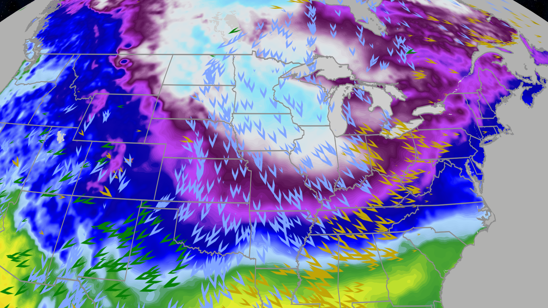
A fresh arctic blast is pushing bitter cold into the Central Plains, Midwest, Great Lakes and much of the East this weekend into early next week, with the coldest air arriving Sunday into Monday; some locations will see temperatures fall more than 30°F below normal, highs stuck in single digits across parts of the Midwest and only teens to low 40s from the Ohio Valley to the Deep South. Subzero morning lows are expected as far south as Indiana, central Illinois and northern Missouri, with spots from the eastern Dakotas into Minnesota, Iowa and western Wisconsin forecast to flirt with daily record lows, and accompanying winds producing wind chills into the teens, 20s and even 30s below zero. Forecast guidance shows another northern-tier cold surge later next week but longer-range models hint at a potential pattern shift that could shove the persistent cold back into Canada by late next week into the Christmas week period.
A powerful arctic blast is forecast to push into the Central Plains, Midwest, Great Lakes and much of the East with the coldest air arriving Sunday into Monday; some locations are expected to be more than 30°F below normal and highs may remain in the single digits from Minnesota into parts of Indiana while the Ohio Valley sees only teens and the Northeast struggles near or below freezing. Subzero morning lows are likely as far south as Indiana, central Illinois and northern Missouri, with readings as cold as the 20s below zero forecast from the eastern Dakotas into Minnesota, Iowa and western Wisconsin, and several areas could flirt with daily record lows.
Strong winds accompanying the front will drive wind chills into the teens, 20s and even 30s below zero across the Northern Plains and upper Midwest, increasing exposure risk and elevating the near-term demand for heating. The Southeast and northern Gulf Coast face freezes into northern Florida, creating potential localized agricultural and infrastructure stress.
Forecast guidance shows another northern-tier cold surge later next week but longer-range models suggest the persistent cold may be pushed back into Canada by late next week into the Christmas week window, implying a sharp, near-term weather-driven shock rather than a sustained multi-week cold regime.
AI-powered research, real-time alerts, and portfolio analytics for institutional investors.
Request DemoOverall Sentiment
neutral
Sentiment Score
0.00
Ticker Sentiment
