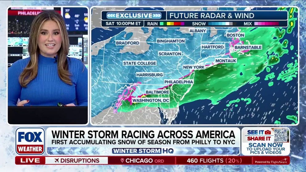
A powerful cross‑country winter storm driven by a resilient Polar Vortex is moving into the Northeast along the I‑95 corridor this weekend, prompting a Winter Storm Warning for Philadelphia and Winter Weather Advisories for New York City, Baltimore and Washington, D.C., amid a busy La Niña winter; the storm will peak Sunday morning and largely exit the Jersey Shore, Long Island and Cape Cod by midday Sunday. Forecasts call for generally light to moderate accumulations—roughly 1–3 inches across much of the I‑95 corridor with localized 4–5 inch pockets in South Jersey and eastern Long Island and some areas seeing 1–2 inches—with extreme cold and wind chills (expected lows near 9°F in D.C. and windchills at or below zero) spurring activation of city winter plans, warming centers and travel advisories; the system already halted travel in the Midwest, producing a multi‑vehicle fatal crash and an I‑55 closure near Springfield. For markets and operators, the immediate implications are concentrated weekend disruptions to travel and ground logistics and a short‑term lift to heating demand and potential utility stress in affected regions, though the event is brief as the storm moves out by Sunday afternoon.
A fast-moving, cross-country winter storm driven by a resilient Polar Vortex is impacting the I-95 corridor this weekend with a Winter Storm Warning for Philadelphia and Winter Weather Advisories for New York City, Baltimore and Washington, D.C.; the system is forecast to peak Sunday morning and largely exit the Jersey Shore, Long Island and Cape Cod by midday Sunday. Forecast accumulations are modest: broadly 1–3 inches across much of the corridor, localized 4–5 inch pockets in South Jersey and eastern Long Island, and 1–2 inches for parts of southern New England, while Washington, D.C. faces an expected low near 9°F and wind chills at or below zero. The storm has already produced significant disruption in the Midwest, including a multi-vehicle fatal crash and an Interstate 55 closure near Springfield, and municipal authorities have activated winter plans—sanitation pre-treatment, plows, and warming centers—in multiple cities. From a market perspective, the event implies a short-lived lift to heating demand and potential localized utility stress; sentiment metrics show mildly negative public tone (sentiment_score -0.3) but only a modest market impact score (0.15), consistent with operational disruption that is material but time-limited.
AI-powered research, real-time alerts, and portfolio analytics for institutional investors.
Request DemoOverall Sentiment
mildly negative
Sentiment Score
-0.30
Ticker Sentiment
