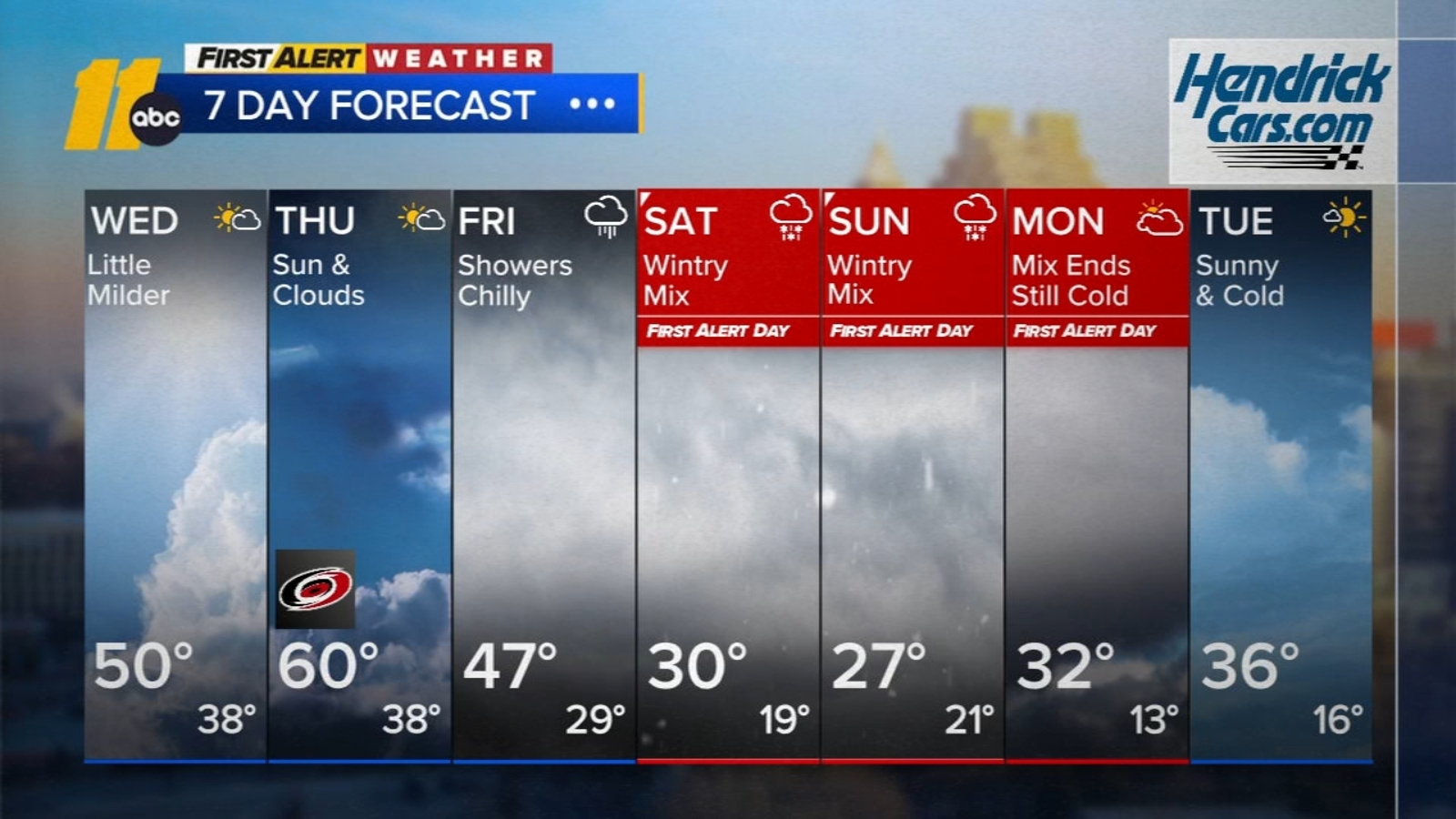
A major winter storm fueled by an Arctic blast is expected to strengthen in the Plains Friday and spread a wintry mix (snow, sleet, freezing rain) over a >1,000-mile swath from northern Texas/Oklahoma to the Carolinas by Saturday night, with significant freezing-rain risk that could produce damaging ice and power outages. Temperatures will plunge — in parts of the Midwest up to ~30°F below normal — prolonging impacts and elevating heating demand, while travel disruption across roads and airports is likely to be widespread. Key implications for markets include near-term upside pressure on energy demand and potential volatility for utilities, regional airlines, and logistics providers exposed to the affected corridors.
Market structure: Arctic blast + multi-state ice storm is a short, sharp demand shock for heating fuels and electricity and an immediate revenue hit for travel/transport. Expect natural gas spot and near-term power prices to spike regionally (Mid-Atlantic/NE/SE) for 7–21 days; airlines (AAL, DAL, UAL) and logistics (UPS, FDX) face measurable revenue losses and higher opex from cancellations and de-icing. Insurers face elevated P&C claims from ice-related property and auto damage concentrated over a few states.
Risk assessment: Tail risks include prolonged multi-day grid outages triggering regulatory inquiries and emergency capex (bad for regulated utility credit spreads) or extreme gas/LP supply bottlenecks pushing winter fuel prices +30%+. Immediate window: 0–14 days for travel disruption and commodity spikes; weeks–months: utility restoration costs and insurance loss adjustments; quarters+: regulatory rate case impacts and capex cycles. Hidden dependencies: pipeline flow constraints, LNG/Canadian supply heat-rate mismatches, and localized counterparty stress in muni/utility bonds.
Trade implications: Tactical long exposure to natural gas (NG futures or UNG) for 1–3 week duration; short exposure to airlines/JETS via weekly puts or put spreads around near-term travel peaks. Favor generators/pipeline toll-takers (KMI, NRG) cautiously for 1–3 month capture of higher power/gas margins; avoid long-duration utility equities (DUK, NEE) that may see short-term outage costs and regulatory attention. Use options to size risk: buy-weekly puts on JETS/AAL and 2–4 week NG call options.
Contrarian angles: Consensus will overprice blanket "utility safety"—physical damage and rate risk can make regulated utilities underperform in the quarter post-storm; conversely, grid equipment and services names (ETN, ITRI, ABB) are underowned and should benefit from accelerated resilience spending over 6–18 months. Historical analogues (Jan ice storms 2014/2018) show sharp commodity moves reverse within weeks, but capex/regulatory impacts persist for quarters — position timeframes accordingly.
AI-powered research, real-time alerts, and portfolio analytics for institutional investors.
Request DemoOverall Sentiment
moderately negative
Sentiment Score
-0.40
