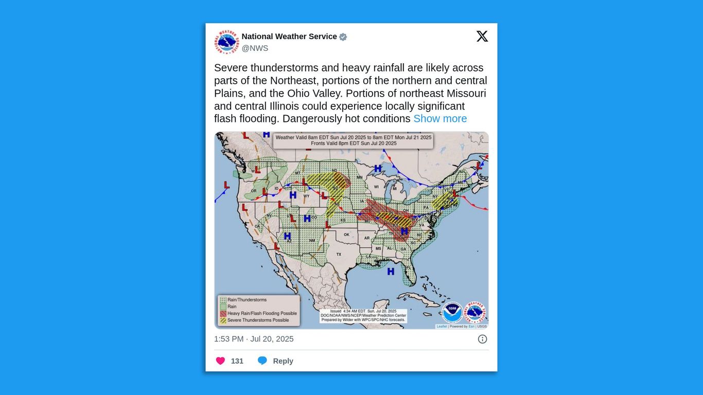
The eastern U.S. and Midwest are experiencing a widespread severe weather event, with over 50 million people under heat alerts and significant risks of severe thunderstorms and flash flooding, including a Level 3 out of 4 excessive rainfall risk for the Ohio Valley. A building heat dome is forecast to bring peak heat indices of 105-115°F to cities like Chicago by midweek. This extensive weather pattern, characterized by frequent lightning, strong winds, hail, and potential tornadoes, is expected to cause disruptions and elevate risks for sectors such as insurance, infrastructure, and agriculture, against a backdrop of record year-to-date flash flood warnings.
A significant severe weather event is unfolding across the eastern U.S. and Midwest, presenting a dual threat of widespread flooding and a major heatwave. NOAA's issuance of a Level 3 out of 4 risk for excessive rainfall in the Ohio Valley, with rates of 3-4 inches per hour, coupled with tornadic activity and severe thunderstorm warnings across New England and the Plains, points to substantial near-term risk. The situation is compounded by a building heat dome expected to drive heat indices to 105-115°F in major hubs like Chicago. This combination is poised to generate significant economic disruptions, particularly for the insurance, agriculture, and utility sectors. The high frequency of severe weather, evidenced by a record 3,160 year-to-date flash flood warnings, suggests a pattern of escalating weather-related losses that will likely pressure property and casualty (P&C) insurers through increased claims and challenge agricultural yields in key farming regions. Furthermore, the extreme heat will strain regional power grids, creating operational risks and revenue opportunities for utility providers.
AI-powered research, real-time alerts, and portfolio analytics for institutional investors.
Request DemoOverall Sentiment
moderately negative
Sentiment Score
-0.60
