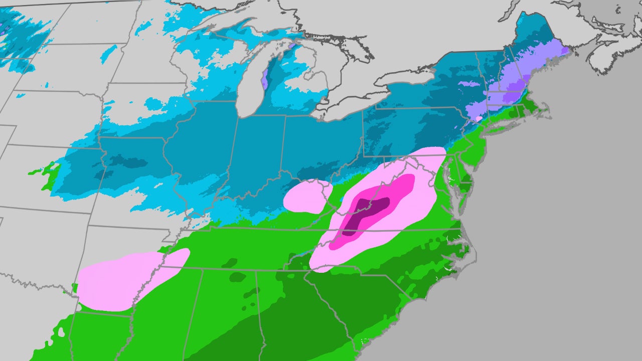
Winter Storm Chan will bring additional snow to the Plains and Midwest Monday (generally 1–3 inches) before moving into the Northeast Tuesday, with 6+ inches possible up the Hudson Valley and localized amounts up to a foot from parts of Massachusetts into southern New Hampshire and southern Maine. The system will also produce sleet and freezing rain from parts of Arkansas into the southern Appalachians early Tuesday, creating hazardous travel conditions and the potential for isolated power outages; monitor regional transportation and utility operations for short‑term operational disruptions, though broader market effects are likely limited.
Market structure: Short, localized snow + multi-day cold increases near-term demand for heating fuels and municipal snow services while depressing transit, air travel, and time-sensitive logistics. Winners: road-salt and snow-removal suppliers (Compass Minerals CMP), regional generators (NRG) and utilities with gas exposure (NextEra NEE) that can monetize higher spark spreads; Losers: airlines (AAL, UAL) and surface carriers (JBHT, CNRYU) face cancellations and margin hit in next 3–10 days. Pricing power is transient — spikes in fuel/ salt volumes are likely 1–6 week phenomena, not structural demand shifts.
Risk assessment: Tail risk includes a heavier-than-forecast nor'easter (>=12" localized) causing sustained outages, CPI transportation distortions, or municipal budget overruns that damage small-cap contractors; probability low but P&L impact outsized for regional utilities and airport-linked businesses. Time horizons: immediate (days) = operational disruptions and volatility; short-term (weeks) = elevated commodity (natural gas, diesel, salt) and airline put implied vols; long-term (quarters) = limited unless repeated extreme winters. Hidden dependencies: municipal procurement cycles, insurance loss notifications, and gas storage withdrawals that lag weather by 1–2 weeks and can amplify price moves.
Trade implications: Prefer short-dated directional and volatility trades: buy puts on AAL/UAL into next 1–2 weekly expiries on any flight-schedule deterioration; establish 1–2% tactical longs in CMP via stock or 90-day call spreads if Northeast snowfall >6" materializes. Play gas via a 1–2% position in UNG or short-dated NG futures if 10-day heating-degree-days (HDDs) beat NOAA by >7%. Consider 1% long in NRG or 3-month call spread on NEE to capture power-spark upside if cold persists beyond two reinforcement shots.
AI-powered research, real-time alerts, and portfolio analytics for institutional investors.
Request DemoOverall Sentiment
neutral
Sentiment Score
0.00
Contrarian angles: Consensus underprices municipal and small-cap beneficiaries of snow contracts — local contractors and equipment OEMs (Toro, MTW) could see outsized Q1 revenue beats if storms repeat; conversely airline put implied vols often overshoot actual losses — fade post-event implied-volatility collapse by selling recovery-week call spreads. Historical parallels: seasonal Midwest storms typically cause 5–12% two-week air-traffic revenue swings but only ~1–3% three-month EPS drift; therefore prioritize short-dated options and event-driven sizing to avoid structural exposure.
