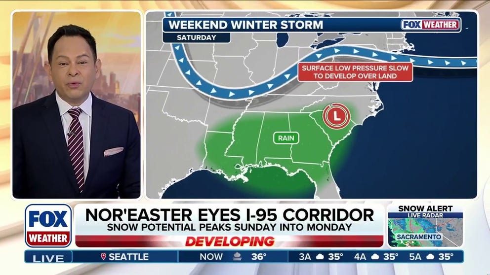
A coastal storm tracking from British Columbia is expected to eject into the U.S. this weekend and could develop into a powerful nor'easter off the Northeast coast Sunday into Monday, threatening heavy snow across the I-95 corridor including Philadelphia, New York City and Boston. Forecasts remain highly uncertain — models (including several AI models) show a range from a miss to a major coastal event, with significant impacts contingent on a slow near-coast track and sufficient Canadian cold air. Market-relevant risks include regional travel and logistics disruption, short-term spikes in energy demand and potential localized infrastructure strain; monitor model convergence and updated timing/track over the next 48–72 hours.
Market structure: A coastal nor'easter would concentrate winners in road‑salt (Compass Minerals CMP), short‑term heating/power suppliers (natural gas spot/UNG, power generators like NRG) and local services (snow removal contractors, short‑dated incremental demand at HD/LOW) while hurting airlines (UAL, DAL), parcel carriers (FDX, UPS) and time‑sensitive logistics (JBHT) for 2–7 days. If the storm tracks within ~50 miles of I‑95 and stalls, regional natural gas demand could rise 5–15% for 3–7 days and peak power prices could spike 20%+, shifting short‑term pricing power toward generators and distributors. Treasuries tend to rally (~10–30bp drop in yields intraday) and equity implied vol on affected names typically jumps 20–60% in the 48–72 hours around landfall. Risk assessment: Tail risks include a major infrastructure outage or multi‑day port shutdown (losses >$1bn regional GDP impact) and insurance claim clustering that would pressure P&C stocks; probability low but P&L impact material. Immediate impacts (0–7 days) are operational; short term (weeks) sees inventory/logistics knock‑on effects; long term (quarters) mostly limited unless repeated storms accelerate capex for resilience. Hidden dependencies: port/rail delays amplify manufacturing supply constraints and municipal budget hits for snow budgets may widen muni spreads; catalyst shifts include model consensus shifts 48–72 hours before landfall. Trade implications: Implement short‑dated, event‑driven trades: tactical long CMP and a 4–6 week UNG call spread sized 1–2% each to capture salt and heating demand; buy 7–14 day 25‑delta put protection on UAL and FDX sized 0.5–1% each or short 1–2% equity positions for immediate downside. Consider long 2–4 week NRG call spreads (1% size) to play spot power spikes, and reduce (trim 1–2%) exposure to time‑sensitive logistics names ahead of the 48–72 hour forecast resolution window. Contrarian angles: Markets often overprice storm risk when models disagree — a miss would snap volatility lower and create mean‑reversion opportunities in airlines/logistics; if models diverge through Friday, implied vols could be 30–50% too rich vs realized. Historical parallels (2013–2018 nor'easters) show a 5–15% rebound in beaten‑down regional transport names within 2–4 weeks after a miss; avoid committing >2–3% capital until model convergence 48 hours out to avoid false positives.
AI-powered research, real-time alerts, and portfolio analytics for institutional investors.
Request DemoOverall Sentiment
neutral
Sentiment Score
-0.10
