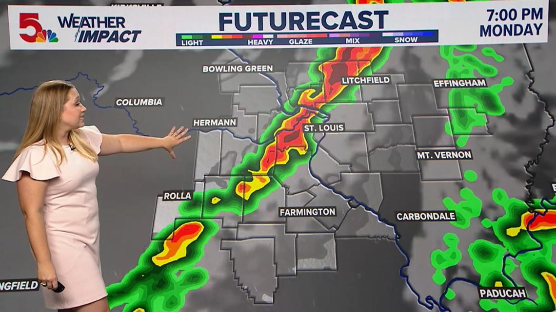
Strong storms are expected to hit the St. Louis region Monday afternoon through evening, with an 80% chance of storms and a Level 4 of 5 severe weather risk. Main threats include damaging winds of 50-70 mph, large hail and tornadoes, with impacts likely during the evening commute before storms move out by about 10 p.m.
This is a short-duration disruption event, but the market impact is asymmetric because the biggest economic damage is not from the storm itself, it’s from throughput friction at the peak commute and end-of-day distribution window. The first-order hit is to local mobility, but the second-order effect is deferred pickups, missed delivery cutoffs, and spillover into next-morning operations for parcel, last-mile, and field-service networks that depend on predictable routing.
The best relative beneficiaries are firms with optionality around rescheduling and remote execution, while the losers are asset-heavy operators that monetize utilization by the hour: local freight, taxi/rideshare, airport-grounded ancillary services, and labor-intensive service businesses. If severe weather forces even a modest 1-day reduction in evening route density, the economic pain compounds through higher deadhead miles, overtime, and service-level penalties — a small weather shock can create a disproportionately large margin hit in businesses with thin fixed-cost absorption.
The tradeable edge is not a blanket risk-off view; it’s a dispersion view. Weather events like this usually get underpriced because headline damage estimates focus on physical loss, but public equities re-rate on near-term revenue deferrals and margin pressure, especially for regional transportation names with limited pricing power. The contrarian angle is that the event may be too localized to matter for broad market indices, so index hedges are likely poor expression unless paired against specific exposed names.
Catalyst window is immediate: Monday afternoon through Tuesday morning. If radar trends weaken or storm track shifts away from the core metro, the selloff in local-exposure names should reverse quickly; if severe weather extends into overnight recovery or produces road closures/power outages, the impact can persist 1-3 sessions via operational backlog and insurance chatter.
AI-powered research, real-time alerts, and portfolio analytics for institutional investors.
Request DemoOverall Sentiment
mildly negative
Sentiment Score
-0.20