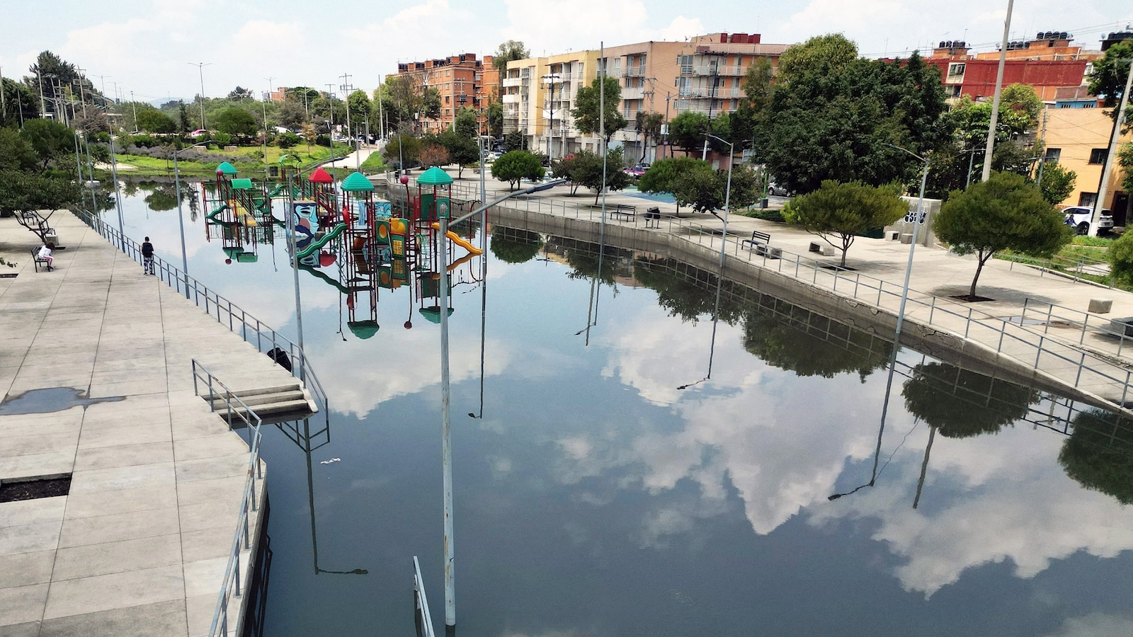
NASA's NISAR satellite is now tracking Mexico City subsidence in near real time, showing parts of the capital sinking by more than half an inch per month. Over the past century, some areas have lost as much as 30 feet of elevation, with the worst-hit zones sinking up to 127 feet, contributing to fractured roads, buildings, and water lines. The report is primarily a technology and urban-risk story, with limited direct market impact but clear implications for infrastructure and real estate risk in subsiding cities.
The investable signal is not the headline subsidence itself; it is the acceleration of maintenance capex and the shift from episodic repairs to perpetual remediation. That favors firms exposed to geotechnical monitoring, leak detection, pipe replacement, and resilient civil works over pure-play homebuilders or broad EM proxies. In markets with chronic land settlement, the winners are usually the “unsexy” vendors selling measurement, stabilization, and asset-life extension rather than new build.
The second-order effect is pressure on urban utility economics: fractured water lines and differential settlement raise non-revenue water, emergency repair frequency, and municipal borrowing needs. That tends to weaken cash flows for local concessionaires and infrastructure operators unless tariffs can reset faster than inflation, which is politically difficult. The timeline matters: this is a years-long degradation story with occasional step-function events after heavy rains, earthquakes, or overpumping cycles that can trigger localized infrastructure failures.
The contrarian read is that the market often underprices how quickly authorities adapt once visibility improves. Near-real-time monitoring can force targeted zoning, capex prioritization, and insurance repricing before a citywide crisis emerges, muting tail risk for well-capitalized owners while hurting marginal landholders and underinsured assets. So the opportunity is less about shorting Mexico outright and more about separating resilient infrastructure owners from assets whose value depends on stable subsurface conditions.
For broader EM exposure, the key risk is policy contagion: if monitoring reveals similar subsidence in other high-growth metros, capital may rotate toward infrastructure/engineering beneficiaries and away from markets with opaque groundwater management. That creates a multi-year thematic tailwind for sensing, inspection, and climate-resilience technology providers, especially those with government procurement exposure and recurring software/data revenue.
AI-powered research, real-time alerts, and portfolio analytics for institutional investors.
Request DemoOverall Sentiment
mildly negative
Sentiment Score
-0.35